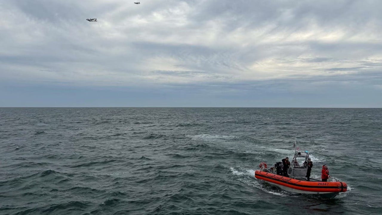
When a commercial flight vanishes over open ocean water between Bermuda and Boston, the operational response immediately shifts from standard emergency tracking to a resource-constrained recovery matrix. The sudden loss of altitude and communication transitions from an aviation incident into a complex marine search operation. Understanding why locating wreckage on the seabed requires vast resources involves examining hydrodynamics, acoustic tracking limitations, and the exact constraints of deep-sea sonar deployment.
Operating thousands of feet below the surface requires precise mapping of ocean floor topography. The Atlantic basin between the mid-Atlantic ridge shelf and coastal shelves contains deep trenches, shifting sediment layers, and thermal gradients that complicate both surface vessel positioning and underwater sensor sweeps. Search planners face a rigid formula where the probability of detection depends directly on water depth, sea state, current velocity, and the acoustic signature of the target debris field.
The Variable Physics of Debris Dispersion
When an aircraft impacts water at high velocity, kinetic energy transfers instantaneously into structural fragmentation. The resulting debris field is rarely concentrated in a single radius. Instead, surface currents, sub-surface thermoclines, and wind vectors scatter buoyant material across broad geographic zones before it can be tagged.
This dispersion creates a fundamental mapping challenge for search coordinators. Surface drift vectors diverge significantly from subsurface descent paths. Heavy structural components, such as engines and landing gear assemblies, sink relatively straight down relative to the impact point, modified only by deep ocean currents. Lightweight composite materials and interior panels drift horizontally over miles.
Reconstructing the original impact location requires inverse trajectory modeling. Search teams feed wind speed records, surface current logs, and water temperature profiles into drift-prediction software. Yet, this remains probabilistic. Every hour that passes widens the elliptical search zone, increasing the surface area that must be scanned by airborne spotters and surface vessels.
Acoustic Localization and Sonar Constraints
Once surface debris is recovered, the focus shifts to locating the main fuselage and the flight data recorders. This phase relies almost entirely on acoustic equipment and active sonar systems.
Commercial aircraft are equipped with underwater locator beacons attached to the flight recorders. These beacons emit a specific acoustic frequency, typically 37.5 kHz, designed to propagate through water over several miles. However, acoustic propagation in the ocean is irregular. Sound waves bend, reflect off thermal layers, and attenuate rapidly based on salinity and pressure.
If the initial acoustic pulses fade before detection, or if the beacons are damaged on impact, search teams must transition to side-scan sonar and synthetic aperture sonar towed behind specialized survey vessels. These systems map the seabed by bouncing sound waves off bottom obstructions.
The operational bottleneck of sonar scanning is sweep width versus resolution. Operating sonar close to the ocean floor provides high-resolution imaging capable of distinguishing aircraft fragments from natural geological formations, but it requires the towed fish to move at slow speeds, often only two to four knots. Conversely, raising the sonar unit increases coverage speed but degrades image resolution, risking missed targets in rugged terrain.
Deepwater Salvage and Seabed Operations
Locating a target on a sonar readout is only the first hurdle. Recovering components from depths exceeding thousands of feet demands heavy engineering assets, including dynamically positioned vessels and remotely operated vehicles equipped with manipulator arms and heavy-lift winches.
Deep ocean pressure and near-freezing temperatures complicate every mechanical intervention. Hydraulics must be specially rated, and umbilical cables connecting surface ships to underwater vehicles suffer from drag caused by deep-sea currents. When recovery teams comb the seabed, they operate under strict physical tolerances. Visibility is near zero, requiring reliance on acoustic positioning transponders and high-frequency sector-scanning sonar mounted directly on the submersibles.
The logistical friction of maintaining a deep-sea recovery operation involves constant coordination between meteorological forecasts, vessel fuel consumption, and crew rotation schedules. Surface support ships must maintain absolute station-keeping over the target zone using thrusters tied to GPS and acoustic positioning arrays, fighting local sea swells to keep the deployment cranes steady.
Future operational success in oceanic search and recovery depends on the integration of autonomous underwater vehicles equipped with onboard processing capabilities. By removing the tether to surface ships and allowing robotic submersibles to map the seabed independently using pre-programmed search patterns, maritime authorities can compress the timeline between initial loss of contact and positive seabed identification.


