The catastrophic flash floods crossing the Nepal-Tibet border have pushed confirmed fatalities past the threshold of one thousand, transforming an isolated high-altitude environmental failure into a multi-national logistical emergency. Standard media coverage reduces this event to escalating body counts and missing person tallies. This approach obscures the structural failure mechanisms of glacial collapse events in fragile mountain corridors. Deconstructing the disaster requires analyzing the hydraulic mechanics, the economic vulnerabilities of concentrated energy infrastructure, and the operational bottlenecks governing modern search-and-rescue efforts in high-relief terrain.
The Hydraulic Mechanics and Cascade Failure
The disaster originated not from seasonal monsoon overflow, but from a high-altitude mountain collapse and subsequent glacial outburst along the China-Nepal border. When millions of tons of ice, stone, and accumulated sediment fail, they displace stored water volumes instantly. This creates a high-density, tsunami-like debris flow moving through narrow river gorges.
Standard river flood models measure volume against gradual seasonal accumulation. Debris flows operate under a different physical equation. The density of the slurry—packed with boulders and structural timber—multiplies kinetic energy exponentially compared to clean water. As this wave accelerates down steep Himalayan gradients, its destructive capacity expands relative to channel confinement. Villages and industrial sites located on historical floodplains or narrow river benches experience zero latency between initial impact and total destruction.
The Infrastructure Vulnerability Index
The heavy loss of life is concentrated around vulnerable economic nodes, specifically hydropower projects constructed along the Trishuli and surrounding river corridors. Modern Himalayan development strategy prioritizes clean energy generation by placing run-of-river dams and tunnel systems directly inside remote gorges.
These installations act as structural traps during extreme debris flows. While concrete diversion dams can handle high water volume, they cannot absorb dynamic boulder impacts. Furthermore, worker housing and tunneling projects are frequently built on low-lying alluvial fans immediately adjacent to water channels. When the debris wave hit, hundreds of workers trapped inside underground construction tunnels faced an immediate spatial squeeze. The interface between industrial expansion in high-risk seismic zones and the increasing frequency of glacial lake outburst floods creates a volatile operational risk profile.
The Resupply and Access Cost Function
Search and recovery operations in districts like Rasuwa and Nuwakot illustrate the severe logistical constraints of vertical geography. Road networks are the primary variable in disaster response speed. When a debris flow shears away valley roads, ground logistics drop to zero efficiency.
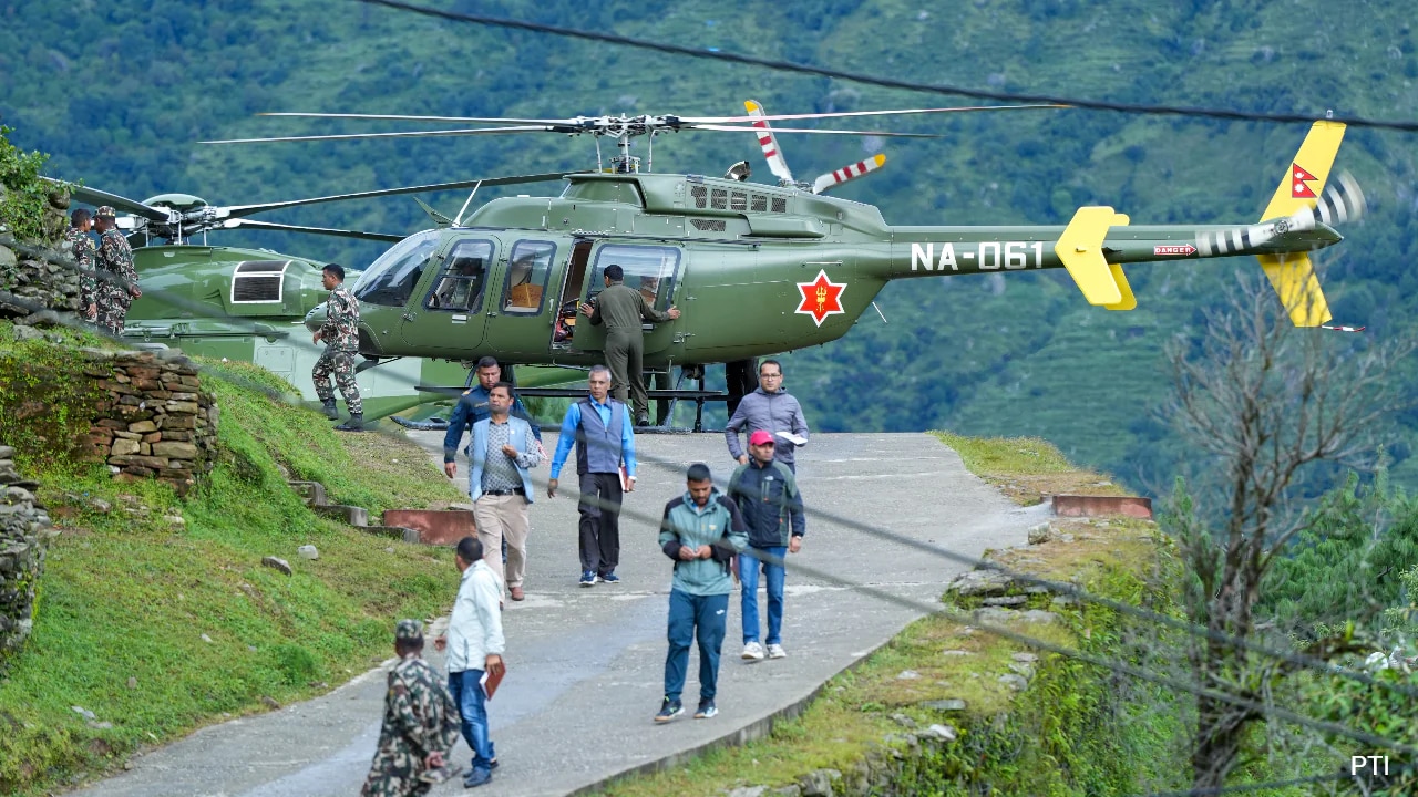
The logistical cost function shifts entirely to rotary-wing aircraft. Helicopters face harsh meteorological boundaries, high-altitude lift restrictions, and narrow valley flight paths. This creates a strict rationing system for fuel, heavy excavation machinery, and medical triage teams. Ground crews moving on foot must clear blockages manually, delaying entry into secondary settlements where survivors face exposure and contaminated water supplies.
The Internationalization of Localized Risk
The geographic distribution of missing persons highlights the modern vulnerability of globalized mountain tourism and spiritual pilgrimage routes. Hundreds of foreign nationals from dozens of countries—including significant cohorts from India, the United States, and European nations—were transiting the border region.
This creates a complex consular matrix. Local disaster management authorities must coordinate cross-border data sharing with Chinese provincial governments, manage foreign embassy inquiries, and process missing person registries for transient populations who lack permanent residential footprints in the affected valleys. The presence of international victims strains diplomatic resources and forces host governments to deploy specialized forensic assets they do not maintain in domestic reserve.
The Forensic Bottleneck
As recovery operations transition from immediate rescue to body retrieval, mortuary capacity emerges as the primary system constraint. High ambient temperatures in lower river basins accelerate decomposition, while remote recovery sites prevent immediate transport to centralized forensic labs.
Authorities are forced to utilize mass burial protocols coupled with mandatory DNA sampling. This preserves identification pathways for families while managing public health hazards. However, the sheer volume of unidentified remains overwhelms local administrative systems, turning DNA matching and dental record verification into a multi-month bureaucratic hurdle.
Strategic Operational Priorities
- Restructure early warning telemetry across high-risk glacial lakes to monitor sub-glacial drainage patterns rather than surface water levels alone.
- Implement mandatory structural engineering setbacks for worker habitations adjacent to high-gradient river corridors.
- Establish pre-positioned international logistics hubs equipped with heavy-lift rotary assets and specialized tunnel-breaching technology to bypass damaged mountain highways within the first twelve operational hours.


